Chappell, NE
Text courtesy of Jim Hebbeln
Description
Latitude 41:05:30 N; Longitude 102:17:01 W (per Google Earth).
Chappell, NE was erected around 1980 and replaced the original Julesburg, CO tower which was 4-5 miles south of Julesburg next to US Highway 385.
The Julesburg site was part of the original transcontinental radio relay route, but its tower was removed after the Chappell junction tower was built about 7 miles north of Julesburg.
The new site eliminated reflection/interference problems which came into existence on the Ogallala-Julesburg hop after the I-80 or I-76 overpasses were constructed.
The new tower is actually located ten miles east of Chappell on the north side of U.S. Highway 30 - or three miles north and one mile east of Nebraska Exit 95 on I-80.
The newer Chappell tower maintained the original transcontinental links between the Ogallala (east) and Peetz (west southwest) sites, but also appears to have provided a new route west to Sunol (milepost 64 on I-80) which then points northwest (Scottsbluff, NE and beyond?).
As of July 2004, Chappell appears to still be in partial operation: There is an addition on the west end of the building; an AT&T fiber optic route sign exists next to Highway 30 south of the building; the air conditioning compressors are operating; and the fiberglass antenna covers toward Sunol are bulging slightly outward - an indicator that the dehydrator is injecting dry air into the waveguides and antennas.
The routes to Peetz and Ogallala are removed from service, but the route to Sunol may still be in service to Sidney and Scottsbluff, NE.
Other Related History
Chappell sits on US Highway 30, which is also known as the Lincoln Highway, the first transcontinental highway.
The highway is parallel to - and often just 100-200' feet away from - the Union Pacific's Transcontinental Railroad across most of Nebraska and Wyoming.
The Oregon Trail preceded the railroad. Interstate 80 now runs roughly parallel.
The original 1913 transcontinental long distance lines likely passed this way, and the subsequently-built buried cable route with red brick "K" repeater huts also ran parallel.
(The K-hut route is about a mile north of Chappell, if I remember correctly.)
Images
Courtesy of Jim Hebbeln
Select an image to view a larger version and read the full caption.
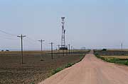
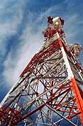
I used a 135mm telephoto lens aimed south at Chappell about 1.5 miles away...[more] |
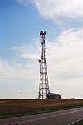
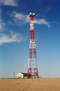
This picture is the southwest side of Chappell...[more] |
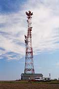
This view shows the south side of Chappell...[more] |
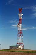
The southeast side of the Chappell tower |
This northeast side of the Chappell tower...[more] |
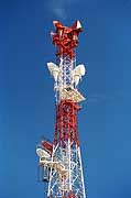
I found the Chappell tower construction interesting as the top platform is rotated 45 degrees from the square foundation of the tower...[more] |
The east face of the Chappell tower above the combiner. |
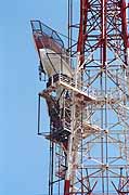
This picture looking north shows that the fiberglass covers of the Sunol route horns are slightly bulging outward...[more] |

This shows the four rectangular waveguides (coming from the radios in the building) being combined into one round waveguide up to the antenna horn...[more] |
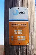
This picture shows that an AT&T "FTA" fiber cable runs into the building...[more] |
Return to...
Created on March 18, 2006 at 22:08 by Albert LaFrance