Arkabutla, MS
Description
Adapted from text contributed by Wayne Weishan
This main station near Arkabutla was the eastern terminal of AT&T's TD3 microwave radio field trial route.
The station served hops to Horn Lake (Memphis), Cockrum, Como (nine hops to Warrior, AL), West Helena and Brickeys.
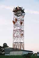
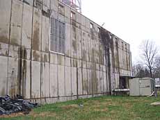
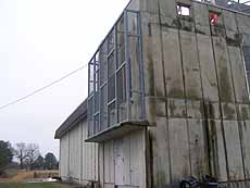
Arkabutla's principal structures consist of a hardened building supporting a 187.5 ft. type J-2P tower, with an upper platform bringing the tower's total height to 202.5 ft.
Arkabutla and Cedarbrook 2, NJ are believed to be the only type J towers which have an upper platform.
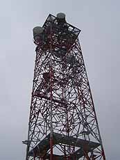
A type J tower can support 12 horns in this configuration.
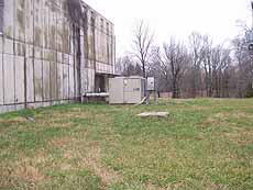
Arkabutla is an example of the "integrated building-tower" design introduced with the TD-3 radio system.
This design places the tower on top of, rather than adjacent to, the building.
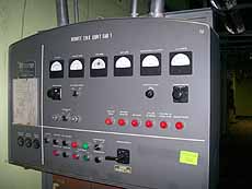
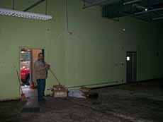
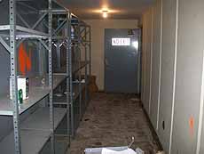
A floor plan shows the arrangement of equipment in the building.
Some of Arkabutla's KS-15676 horn-reflector antennas appear to have an early fix for the so-called "weather-cover lobe".
Part of the main-lobe energy passing through the weather cover was reflected back upward into the horn, appearing as a 30-degree off-axis signal.
The reflector would refocus this to a virtual feed point in front of the horn, producing a strong (-38 dB) sidelobe about 65-degrees below bore-sight.
A pathway was thus created for interaction with foreground objects (trees and buildings on the ground, platform hand rails on the tower) causing antenna-system echoes and reducing side-to-side coupling loss.
This problem resulted in development of the so-called "diving board" or "front-porch" blinder seen on many horns, and was problably the main incentive for removal of tower ironwork in front of the antenna.
The blinder simply deflected the lobe upward into space. (see: "Three-Dimensional Radiation Characteristics of a Pyramidal Horn-Reflector Antenna", Bell System Technical Journal, July-August 1981).
To reach Arkabutla from the West Helena TD3 station, backtrack to SR 185 and US49.
Left-turn east on US49 and cross the Mississippi River.
Take US 61N 16 miles to SR4, go east on SR4 to Savage, then north on Arkabutla-Savage Rd.
The site is on the left side of the road, just west of Arkabutla.
A bonus: you'll pass the Dundee, MS flood-plain TD2 site on the west side of US61.
It features a 275.0 ft type H tower and a 35 ft. tall building with all equipment on the second floor to clear the Mississippi floodwaters.
Images
Select image to view a larger version
Courtesy of Wayne Weishan |
Courtesy of Blake Bowers |
Courtesy of Blake Bowers |
Courtesy of Blake Bowers |
Courtesy of Blake Bowers |
Courtesy of Blake Bowers |
Courtesy of Blake Bowers |
Courtesy of Blake Bowers |
Courtesy of Blake Bowers |
Return to...
Updated on April 26, 2008 at 21:19 by Albert LaFrance