Images
Images courtesy of wb8foz
Select image to view a larger version


Common Language Location Identifier (CLLI): unknown
GeoHack: http://toolserver.org/~geohack/geohack.php?params=39_27_40_N_78_20_47_W
Address: within West Virgina's Cacapon State Park, Berkeley Springs, WV 25411
Latitude: 39.461367°
Longitude: -78.346623°
Elevation: 2320 ft
Location: unknown
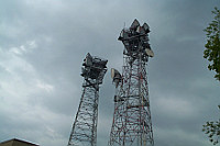
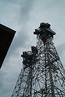
Omps is a large double tower station with both KS-5759 and circular horns. It is located in Virginia, but is within West Virgina's Cacapon State Park. It sits in a wide spot on an otherwise narrow ridgeline.
Omps had shots to the Hagerstown 2 and Leesburg 5 Project Offices, and Mt. Weather aka Berryville #2/Washington 4. It also had links to Lebanon Church, Clear Springs, Linden, and Frostberg.
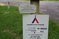
While a sign declares it is still an active AT&T microwave
site, it is very quiet within the building. One or two of the horns may
still be pressurized; others clearly are not.
Omps was built in the late 1950's & fed Mt. Weather. The 2nd tower and building expansion were added later when links to the Project Offices were needed.
 |
 |
 |
Created on September 18, 2010 at 02:37 by wb8foz
Updated on February 14, 2011 at 01:02 by wb8foz