Yellow Springs, MD
Also known as Catoctin Mountain
Common Language Location Identifier (CLLI): YLSPMDQ0010
Site Data
Address: off Gambrill Park Rd. just north of Gambrill State Park, Frederick County, MD
Latitude: N39-29-38 (39.49389)
Longitude: W77-29-55 (-77.49861)
Elevation: 1730 ft. ( M)
FCC Microwave License Data
Description
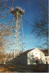
Yellow Springs consists of a self-supporting steel tower and a concrete-block equipment building in two gable-roofed sections,
located among other radio communications facilities in mountaintop "tower farm".
The style of the building is typical of AT&T's older microwave and coaxial-cable repeater stations.
Historical Role
Thanks to Terry Michaels for his contributions to this section
Yellow Springs was a relay station on the microwave route between the Garden City station in Arlington, VA and the Clark's Knob station near Upper Strasburg, PA.
During at least some of its history Yellow Springs carried only television programming, with its ultimate destinations being
Washington, DC and New York City.
The station was constructed in the early years of the Long Lines network, beginning service on September 18, 1950.
Articles in the Bell Laboratories Record issues of March 1950 and November 1950 discuss the Washington-New York City
route. A U.S. Army Signal Corps memorandum dated 4 May 1951 also mentions the facility.
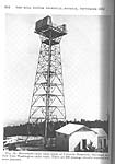
Initially, the tower at Yellow Springs was equipped with delay-lens antennas, as shown in the 1952 photograph below.
This type of antenna, installed on AT&T's early microwave routes, operated only in the 4-GHz band and only handled one signal polarization with six RF channels.
The delay-lens antennas were replaced in the 1980s by shielded parabolic "dish" antennas, 10 feet in diameter (bottom row of photos).
This change, made at a number of northeastern stations, was due to the problem of moisture accumulating in the polystyrene foam elements of the delay-lens antennas.
The reason for the station's dual names is not known.
Long Lines route maps from 1970, 1979, and 1988 identify the facility as Yellow Springs,
while the 1966 and 1976 maps, and the Signal Corps memo, call it Catoctin Mountain.
Route Map

Present Function
Yellow Springs is now owned by a tower-site leasing firm, and the tower hosts numerous antennas for various communications services.
All of the AT&T microwave antennas have been removed.
Images
Select an image to view a larger version
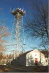
Photographed March 25, 2001 |
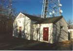
Photographed March 25, 2001 |
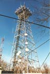
Photographed March 25, 2001 |
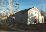
Photographed March 25, 2001 |
Photographed March 25, 2001 |
ca. 1952; from the Bell System Technical Journal, September 1952 |
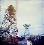
Tower in left foreground (with cabin) is Western Union's Gambrill Park microwave station, now owned by the Federal Aviation Administration.
Image courtesy of Terry Michaels |
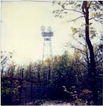
Image courtesy of Terry Michaels |
Return to...
Updated on March 31, 2004 at 21:56 by Albert LaFrance


