Images
Courtesy of Jim HebbelnSelect an image to view a larger version.
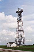
This is the south side of the Adair tower.
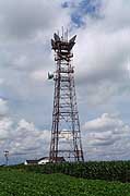
This is the southwest top of the Adair tower.
Latitude 41:29:20 N; Longitude 94:37:59 W (per Google Earth).
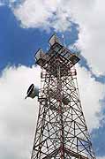
Adair was an auxiliary (relay) station on AT&T's first transcontinental microwave radio route, linking Earlham to the east and Elk Horn junction to the west. Like all of the stations on that route, Adair was originally equipped with KS-5759 delay-lens antennas, which were replaced with KS-15676 horn-reflectors. It is one of the first steel lattice type towers with the classic little white house for the power and radio equipment. The tower appears to be about 175 feet high.
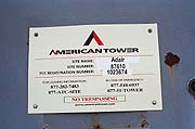
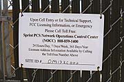
It is now owned by American Tower Corporation and it is their Site #87610. Sprint Communications uses the tower for a cell site.
The site is located about one mile south and one half mile east of Adair. It is very obvious to anyone traveling on I-80 near Mile Post 78.
|
This is the south side of the Adair tower. |
This is the southwest top of the Adair tower. |
|
|
Created on February 24, 2006 at 01:42 by Albert LaFrance